Your cart is currently empty!
Printing Topology
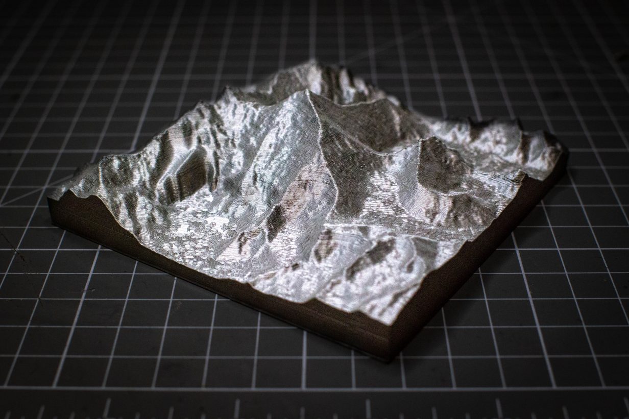
I had the idea that it would be fun to print out a mountain. Specifically, Cader Idris, a mountain in Wales that I had walked up.
I assumed that someone (probably smarter than me) had done this before. The good news is that they had but it took a bit of research to find the best tool. There are several options but my recommendation is Touch Terrain.
While more “Functional” looking than some of the alternatives, I found it was the most intuitive to use while still providing the functionality that I wanted.
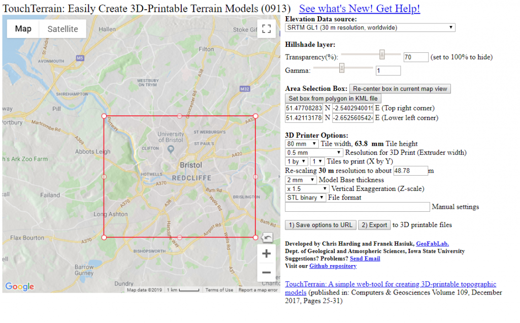
How to Use it:
Most of the settings are pretty self-explanatory but lets go through it anyway.
- Navigate to the area of the globe you’d like to print using the map directly, or punch in some coordinates
- Choose the data source. Pick the source with the best resolution (lowest number) that covers the area you’d like to print
- Use the transparency slider to see the topology data overlaid onto the map to get a preview of what the print will look like
- Printer Options:
- The tile width chooses the default width of the tile, the height is determined by the shape of the region you’ve selected
- Resolution; there’s very little reason to lower this setting, however choosing a significantly lower value wont improve the print much but will make the file much larger.
- The tile print option is fun, it lets you break the area up into smaller sections, great if you want to print a larger area and/or have a small print volume
- re-scaling is similar to resolution, you can increase it to reduce file size and processing time but its worth setting this to the smallest value (The resolution of the topology source)
- The base thickness simply adds a given value to the bottom of the tile. It looks a little weird if turn it off but its useful if you want sea-level to actually be the ground for example
- Vertical Exaggeration you just have to play around with until your file looks about right. 1.5 is usually good but if your printing a large area you may want to increase this.
- Unless you specifically want something different, leave the file type as STL and hit export.
This is a fun way to remember trips that you’ve taken, plan trips your going on or, if like you me you thinks it just cool, you can of course print out Mt Everest and keep it on a shelf in your home.
Leave a Reply